
Malawi in Maps
 here are plenty of low-resolution maps of Malawi online.
If all you care about is the general shape of the lake and the country, with maybe a few major towns, they are fine.
But if you want more detail, there's not much out there. Until now.
You might be planning a trip there. Or studying African geography. Maybe (like me) you just like to study
maps of the places you're interested in, learn the exotic placenames, understand where the rivers flow from and to,
or note where the airfields are to plan a well-equipped fantasy expedition sometime, after you win the lottery.
I brought home
quite a few detailed Malawi maps and charts from my trips there, obtained at the Malawi Department of Surveys in Blantyre.
They are so much more detailed than anything else online, in hobbyist books, or even in a large atlas!
 ow I've been scanning them to present here.
That's not so easy. They are far too large to fit on a consumer-level scanner. Each map
needs to be moved around so that 12 or more overlapping scans can be made of its large surface. The map must be kept in
perfect alignment when moved between scans. When all parts have been scanned, I reassemble the map in my graphics software
(currently, I'm using Corel PaintShop Pro X4). Some sections fit together perfectly; others may be off by a pixel or two, but
the readability of the map is not compromised. Sometimes further tweaks or a rescan of a part is necessary. Altogether,
each map takes about 2 to 3 hours of work.
Below is the complete set of 10 sheets (1974-76 editions) covering all of Malawi at a scale of 1:250,000. This hard-to-find set can be ordered
on paper for around US$300, if available, from an online vendor or two, but is freely available here as full-size JPGs of 3 to 5 megabytes each.
All maps will open in the same second tab or window — if a map appears not to have loaded, check other open tabs. I scanned them at 150 dpi;
they can be enlarged to original size with little loss in quality. (Once loaded in the browser, click the map to toggle between full size and fit-to-window.)
Every name should be as legible as on the paper original.
Also:
Also check out my antique maps of Africa.
Click thumbnail to open map in another window
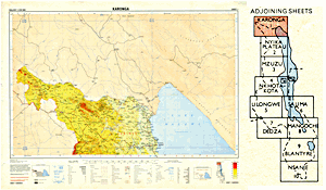 |
Sheet 1 (Karonga), Malawi 1:250,000 (1976)
Filesize 4.1 MB, image size 4552 × 3496
Description: Includes northernmost Malawi and the north end of Lake Malawi; lakeshore towns Nkanda (Tanzania), Ikombe (Tanz.),
Matema (Tanz.), Itungi (Tanz.), Songwe (Tanz.), Kaporo (Mal.), Karonga (Mal.), and others
|
Click thumbnail to open map in another window
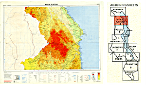 |
Sheet 2 (Nyika Plateau), Malawi 1:250,000 (1976)
Filesize 3.9 MB, image size 4268 × 3428
Description: Includes part of northern Malawi and part of northern Lake Malawi; town of Livingstonia; the Nyika Plateau; Lake Chiwondo, Mulale Lagoon,
Youngs Bay, Chitimba Bay; North Rukuru and South Rukuru Rivers; lakeshore towns from Ngosi to Zumbe, including Usisya, Ngara, Mdoka,
Chilumba, Khondowe, Hora Mhango, and others
|
Click thumbnail to open map in another window
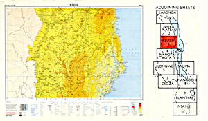 |
Sheet 3 (Mzuzu), Malawi 1:250,000 (1976)
Filesize 4.3 MB, image size 4259 × 3519
Description: Includes north-central Malawi and part of central Lake Malawi; town of Mzuzu; the South Rukuru River; Limphasa Dambo; lakeshore towns from Mkondowe to Mwaya,
including Ruarwe, Usisya, Nkhata Bay, Mankhambira, Chintheche, and others
|
Click thumbnail to open map in another window
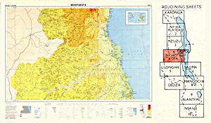 |
Sheet 4 (Nkhotakota), Malawi 1:250,000 (1976)
Filesize 3.9 MB, image size 4447 × 3519
Description: Includes part of central Malawi and central Lake Malawi; Likoma and Chisumulu (or Chizumulu) Islands; the Dwangwa River; Kalali Swamp, Unaka Lagoon, Bana Swamp, Kazilila Dambo,
Nkono Swamp, Dzadza Swamp, Bua Point, Sungu Spit; Lake Chikukuta; lakeshore towns from Ndawambe to Chiputula, including Mlenga Senga, Makuta, Nkhotakota, and others
|
Click thumbnail to open map in another window
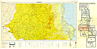 |
Sheet 5 (Lilongwe), Malawi 1:250,000 (1975)
Filesize 4.3 MB, image size 5484 × 3398
Description: Includes much of central Malawi, the capital city Lilongwe, Kasungu, Salima; Chia Lagoon, Nkumbaleza Swamp, Mbenji (Mbenje) Island, Domira Bay,
Sungu Point, Maleri Islands, Kambiri Point; Lilongwe River, Linthipe River; lakeshore towns from Sani to Chipoka, including Mwadzama, Makanjila, Kachulu, Senga, Maganga, and others
|
Click thumbnail to open map in another window
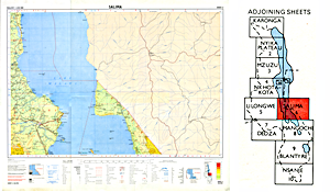 |
Sheet 6 (Salima), Malawi 1:250,000 (1975)
Filesize 2.9 MB, image size 4182 × 3477
Description: Includes eastern central Malawi and part of southern L. Malawi (repeats same western lakeshore area as Sheet 5); Chia Lagoon, Mbenji Island, Domira Bay,
Sungu Point, Maleri Islands (but with Nakantenga Island mislabeled Nankoma Island in duplication of the actual Nankoma Island in the group), Kambiri Point, Mumbo Island,
Domwe Island, Zimbawe Rock, Chinyankwazi Island, Chinyamwezi Rock; Lilongwe River, Linthipe River;
lakeshore towns from Sani to Chipoka, including Mwadzama, Makanjila, Kachulu, Senga, Maganga, and others on W shore, as well as Mponda (Mozambique), Nkukuta, Makanjila Point,
Cape Ngombo, Makanjila, Mdala, and other towns, and Rivers Luaice, Luangua, Nsinje, and Lilole on E shore of lake
|
Click thumbnail to open map in another window
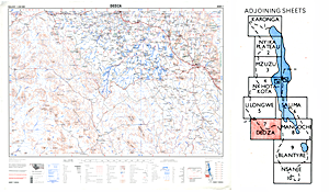 |
Sheet 7 (Dedza), Malawi 1:250,000 (1974)
Filesize 5.0 MB, image size 4211 × 3431
Description: Includes southwestern Malawi; cities of Lilongwe and Dedza; Lilongwe River, Linthipe River; part of Mozambique
|
Click thumbnail to open map in another window
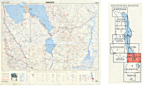 |
Sheet 8 (Mangochi), Malawi 1:250,000 (1974)
Filesize 3.1 MB, image size 4079 × 3430
Description: Includes part of south central Malawi and the southern arms of L. Malawi; Mumbo Island, Thumbi Island West, Cape Maclear, Domwe Island, Boadzulu Island;
lakeshore towns Chitipi, Malembo, Kasankha, Monkey Bay, Nkhudzi, Mpwepwe, Namiasi, Palm Beach, Mponda, Mangochi, Malindi, Chiponda, and others;
as well as the upper Shire River, Lake Malombe, part of the middle Shire River; Lake Chiuta (Malawi), Lake Amaramba (Mozambique)
|
Click thumbnail to open map in another window
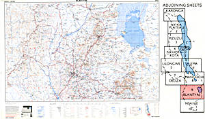 |
Sheet 9 (Blantyre), Malawi 1:250,000 (1974)
Filesize 4.5 MB, image size 4810 × 3583
Description: Includes part of southern Malawi; cities of Zomba and Blantyre-Limbe; the Shire River from Liwonde past Walkers Ferry and its confluences with
the Lisungwe and Mkurumadzi Rivers to Chikwawa; Lake Chilwa; the Mulanje Massif
|
Click thumbnail to open map in another window
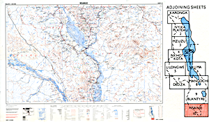 |
Sheet 10 (Nsanje), Malawi 1:250,000 (1975)
Filesize 4.3 MB, image size 4825 × 3539
Description: Includes southernmost Malawi; town of Nsanje; the lower Shire River from Mlomba village through Elephant Marsh and its confluence with
the Ruo River to the villages of Mpatsa, Mkhokwe, and others; also part of the Zambezi River; parts of Mozambique
|
Click thumbnail to open map in another window
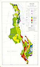 |
Malawi 1:1,000,000 map of Vegetative and Biotic Communities (1979)
Filesize 4.5 MB, image size 4338 × 7348
Description: A color-coded map of the country of Malawi, showing the distribution of its plant communities
|
Click thumbnail to open map in another window
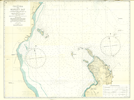 |
Malawi 1:72,000 chart, Chipoka to Monkey Bay
Filesize 3.9 MB, image size 6786 × 5071
Description: Chart showing depths in fathoms (1 fathom = 6 feet = 1.83 meters); under 11 fathoms, depths are shown in fathoms and feet,
e.g. 43 = 4 fathoms 3 feet = 27 feet. There is no publication date, but the chart is based on a 1957 survey and predates Malawi's 1964
independence as it mentions the Nyasaland Government; I obtained the chart in 1971 in Malawi. This may be the older of two editions I own of the chart.
It displays the prominent number 6. at upper left and seems to be sheet 6 of a series. My other copy of the same chart substitutes 9 at
upper left, and below the lower left edge of the black outline is the notation "small corrections" which is absent on the present copy. I scanned
the chart at 200 dpi and assembled the sections in my graphics software; as the sections (despite care taken) were not all exactly parallel, lines
do not meet precisely in a few spots. However, no information is lost.
|
Click thumbnail to open map in another window
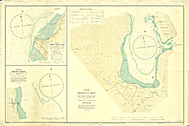 |
Malawi 1:3600 chart, Monkey Bay (insets: Fort Maguire (Makanjila) 1:8000; Chipoka Roads 1:9000)
Filesize 4.6 MB, image size 7898 × 5267
Description: Chart showing depths in fathoms (1 fathom = 6 feet = 1.83 meters); under 11 fathoms, depths are shown in fathoms and feet,
e.g. 43 = 4 fathoms 3 feet = 27 feet. The publication date (of the initial edition?) was 31 December 1956, but this copy says "small corrections"
at lower left, and "New Edition 1st March 1958" at lower right. It was printed at Salisbury, Rhodesia in the days of the Federation of Rhodesia and Nyasaland.
Sheet scanned at 200 dpi and the 18 sections assembled in graphics software.
|
Click thumbnail to open map in another window
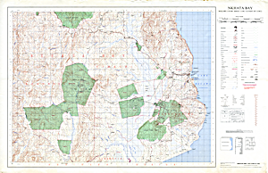 |
Malawi 1:50,000 map of Nkhata Bay region (1979)
Filesize 5.8 MB, image size 7688 × 4964
Description: A detailed map (individual huts and other buildings are shown) of the Nkhata Bay region of Malawi, including the north-central part
of the Lake Malawi shore. The map is identified as "Nkhata Bay sheet 1134C1 and part of 1134C2" and is dated 1979. Scanned at 200 dpi; some lines
do not quite meet across the left midsection, but no information is lost.
|
Return to top

![]() here are plenty of low-resolution maps of Malawi online.
If all you care about is the general shape of the lake and the country, with maybe a few major towns, they are fine.
But if you want more detail, there's not much out there. Until now.
here are plenty of low-resolution maps of Malawi online.
If all you care about is the general shape of the lake and the country, with maybe a few major towns, they are fine.
But if you want more detail, there's not much out there. Until now.
![]() ow I've been scanning them to present here.
That's not so easy. They are far too large to fit on a consumer-level scanner. Each map
needs to be moved around so that 12 or more overlapping scans can be made of its large surface. The map must be kept in
perfect alignment when moved between scans. When all parts have been scanned, I reassemble the map in my graphics software
(currently, I'm using Corel PaintShop Pro X4). Some sections fit together perfectly; others may be off by a pixel or two, but
the readability of the map is not compromised. Sometimes further tweaks or a rescan of a part is necessary. Altogether,
each map takes about 2 to 3 hours of work.
ow I've been scanning them to present here.
That's not so easy. They are far too large to fit on a consumer-level scanner. Each map
needs to be moved around so that 12 or more overlapping scans can be made of its large surface. The map must be kept in
perfect alignment when moved between scans. When all parts have been scanned, I reassemble the map in my graphics software
(currently, I'm using Corel PaintShop Pro X4). Some sections fit together perfectly; others may be off by a pixel or two, but
the readability of the map is not compromised. Sometimes further tweaks or a rescan of a part is necessary. Altogether,
each map takes about 2 to 3 hours of work.


